|
Bangor, Wales, UK - 25th February 2010
By: miapearl
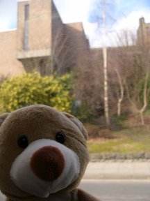
I was bought from a charity shop in Bangor. Within minutes of leaving the shop, I found myself on a bus. Out of the window, you can see a bit of the university.We were going to have a nice cup of tea in a supermarket cafe.
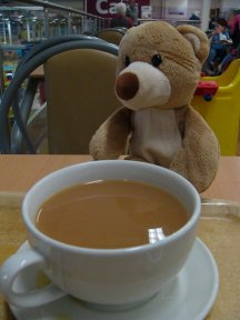
We did a bit of shopping before catching more buses to take me home.
|
|
 Posted Feb 26, 2010, 1:28 pm Last edited Mar 17, 2010, 6:19 pm by miapearl
[Quote] [View just this post] Posted Feb 26, 2010, 1:28 pm Last edited Mar 17, 2010, 6:19 pm by miapearl
[Quote] [View just this post]

|
|
|
Caernarfon, Wales, UK - 25th February 2010
By: miapearl
We took the bus from Bangor to Caernarfon and had a few minutes to look around town before going home. The castle here is a UNESCO World Heritage Site. This is where Prince Charles received his title, Prince of Wales.
|
|
 Posted Feb 26, 2010, 1:31 pm Last edited Mar 17, 2010, 6:23 pm by miapearl
[Quote] [View just this post] Posted Feb 26, 2010, 1:31 pm Last edited Mar 17, 2010, 6:23 pm by miapearl
[Quote] [View just this post]

|
|
|
Caernarfon, Gwynedd - 26th February 2010
By: miapearl
My mum and I went out to post a letter and some Postcrossing postcards. The weather wasn't all that great and I think I felt a spot of rain so we didn't do much else. Here is me lounging on top of a red pillar postbox.
|
|
 Posted Feb 26, 2010, 8:44 pm Last edited Feb 27, 2010, 9:17 pm by miapearl
[Quote] [View just this post] Posted Feb 26, 2010, 8:44 pm Last edited Feb 27, 2010, 9:17 pm by miapearl
[Quote] [View just this post]

|
|
|
Gwynedd & Anglesey (now home), Wales, United Kingdom - 27th February 2010
By: miapearl
|
|
 Posted Feb 27, 2010, 8:54 pm Last edited Mar 17, 2010, 6:25 pm by miapearl
[Quote] [View just this post] Posted Feb 27, 2010, 8:54 pm Last edited Mar 17, 2010, 6:25 pm by miapearl
[Quote] [View just this post]

|
|
|
Caernarfon and surrounds, Wales, United Kingdom - 28th February 2010
By: miapearl
|
|
 Posted Feb 28, 2010, 7:26 pm Last edited Feb 28, 2010, 7:30 pm by miapearl
[Quote] [View just this post] Posted Feb 28, 2010, 7:26 pm Last edited Feb 28, 2010, 7:30 pm by miapearl
[Quote] [View just this post]

|
|
|
|
|
Cwm Idwal, Wales - 6th March 2010
By: miapearl
Today was another nice day. Daddy decided it was a nice afternoon for a walk in Snowdonia.
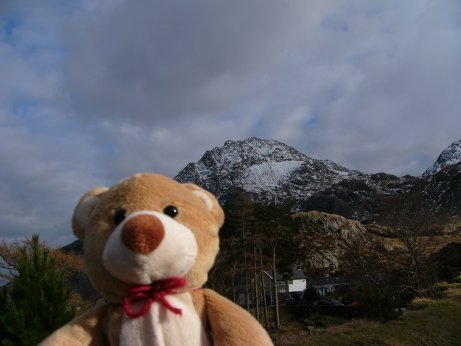
This is Tryfan and reaches over 3000ft above sealevel. We did not climb this!
We started the walk from Ogwen Cottage (there is a Youth Hostel nearby). We followed a stone path up.
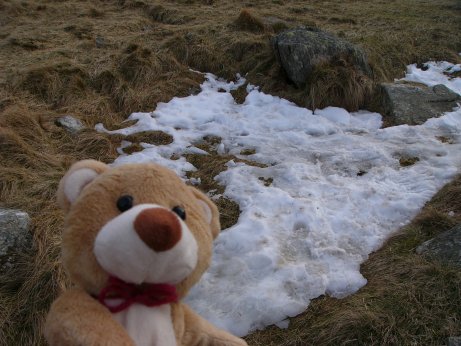
Bits of snow still remained.
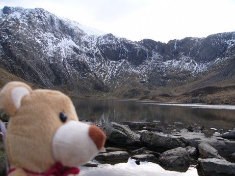
We walked as far as this lake, Llyn Idwal in Cwm Idwal. The mountain ridge on the other side of the lake is Glyder Fawr, and is even higher than Tryfan!
We passed several groups of people that had climbed up higher, as well as others just going as far as the lake.
On the way down, mummy saw some mountain goats but they were too quick to allow mummy to take a picture of me with them.
|
|
 Posted Mar 7, 2010, 9:03 pm
[Quote] [View just this post] Posted Mar 7, 2010, 9:03 pm
[Quote] [View just this post]

|
|
|
|
|
Post Office, Wales - 10th March 2010
By: miapearl
Goodbye Mummy, I will miss you. I will be fine in Germany, the nice people on the German Trail will look after me and show me the sights.
|
|
 Posted Mar 10, 2010, 2:52 pm
[Quote] [View just this post] Posted Mar 10, 2010, 2:52 pm
[Quote] [View just this post]

|
|
|
Remscheid, Germany - 16th March 2010
By: olgamaus
Hi Mummy,
I arrived in Remscheid today. I am so tired that the first photos will follow tomorrow.
Bye
Captain Caramel
|
|
 Posted Mar 16, 2010, 8:13 pm
[Quote] [View just this post] Posted Mar 16, 2010, 8:13 pm
[Quote] [View just this post]

|
|
|
|
|
|
|
|
|
Vulkan Eifel, Germany - 27th March 2010
By: olgamaus
Hi Mummy,
we made a trip to the region Vulkan Eifel, situated in the northwest of the state Rhineland-Palatinate, in the Eifel Mountains , that is defined to a large extent by its volcanic geological history. Characteristic of the Vulkan Eifel are its typical explosion crater lakes or maars, and numerous other signs of volcanic activity such as lava streams, volcanic tuffs, and volcanic craters. We visited the Dauner Maare, a group of three maars close to each other.
A maar is a broad, low-relief volcanic crater that is caused by an explosion caused by groundwater coming into contact with hot lava or magma. A maar than fills with water to form a relatively shallow crater lake.
When we parked the car close to one of the maars we read some information signs.


This is Weinfelder Maar, Its diameter is 525 m and it is about 51 m deep.


Soon we reached the next maar, Schalkenmehrerer Maar. Its diameter is 575 m and it is about 21 m deep.


This region is a nature protection area.


We went into this small town Schalkenmehren. Here we saw fantastic statues which made cut with a chainsaw out of tree trunks.


We walked round the maar and went back to Weinfelder Maar.

We walked uphill to have an overlook from a nearby mountain which is called "Mäuseberg" (mice mountain), 561 m high.


Even from half of the height of this mountain we had a great view at the surrounding landscape.

We reached the top of the mountain and rested here for a while.

Here on top of the hill we saw this tower. You can climb onto it.

Here you can see the third one of the Dauner Maare, Gemündener Maar, the smallest one with only 325 m diameter.

We had a look at this sign which is showing the names of the mountains you can see from here.

When we walked back downhill we saw this: a ski-lift.

This was a wonderful trip and I liked to see this fantastic landscape.
Unbelievably the sun was shining when we drove back home.

Bye
Captain Caramel
|
|
 Posted Mar 27, 2010, 9:40 pm Last edited Mar 28, 2010, 4:04 pm by olgamaus
[Quote] [View just this post] Posted Mar 27, 2010, 9:40 pm Last edited Mar 28, 2010, 4:04 pm by olgamaus
[Quote] [View just this post]

|
|
|
Solingen, Schloss Burg, Germany - 31st March 2010
By: olgamaus
Hi Mummy,
today we took a walk in the neigbour town Solingen. Katja wanted to show me Schloss Burg, a medieval castle. We startet in Solingen-Unterburg, an old district situated at the River Wupper.
You can walk uphill to the castle or you can take a chair-lift.

Of course we walked to the castle, we had to walk through a forest for some time.

The first flowers!

We reached an outlook pavilion than. From here you can overview the valley of the River Wupper.


The castle came into sight than.


Schloss Burg was built in 1133 by Count Adolf I von Berg on a hill above the river Wupper.That's why this region is called "Bergisches Land". Many people believe that it's name refers to the landscape with hills and valleys. (For those who do not speak German: The German word for mountain or hill is "Berg", so many people think that the name "Bergisches Land" means "land with many hills" )
About a hundred years later it was enlarged by Count Engelberg II von Berg. The equestrian sculpture in the courtyard is showing him.
In Thirty Years War (17th century) many parts of the castle were destroyed. It was rebuilt then, but it was used for industrial purposes for many years. In the end of the 19th century they began to rebuild it as it appears today.
In the castle courtyard you can find souvenir shops and shops whose owners are doing an "old" handcraft. For example someone makes soap, another makes brushes, then you can buy things that were used by knights for the kids, like swords and helmets.


I also saw this statue.

This is a very old linden tree, it is about 250 years old and it is called "Kaiserlinde".

Here is the end point of the chair-lift. From here you can see how steep this hill is.

We left the castle than and went further. We walked through a rural outskirt of Solingen, Hoehrath.

We came to another forest. In the background you can see the city centre of Remsheid high upon the hill on the right side ...

... and also Schloss Burg in the distance.

We walked downhill until we reached the River Wupper.

We followed the river to get back to the car.


We reached Unterburg than. Katja showed us this statue, showing a "Kiepenkerl". In ancient times all sorts of goods were transported by men who carried the goods in large panniers on their back. This rangy landscape was too steep for horses. Those persons were called "Kiepenkerl". This one has sweet pretzels in his pannier, a local delicacy.


Katja bought pretzels for us in a bakery. We will taste them with a coffee later.
Bye
Captain Caramel
|
|
 Posted Apr 1, 2010, 10:03 am
[Quote] [View just this post] Posted Apr 1, 2010, 10:03 am
[Quote] [View just this post]

|
|
|


