|
on the road, Germany - 15th May 2013
By:  fam-united fam-united
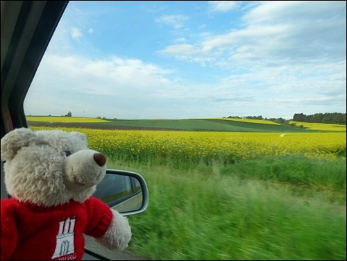
We are on the way to Bad Wildbad, where our host's husband has an appointment. As the weather was so terrible again during the last weeks, we took the chance to take some photos today.
|
|
 Posted Jun 2, 2013, 8:09 pm
[Quote] [View just this post] Posted Jun 2, 2013, 8:09 pm
[Quote] [View just this post]

|
|
|
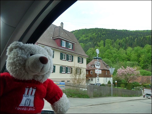
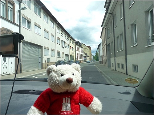
Bruchsal, Germany - 20th May 2013
By: fam-united
Today I'm on a sightseeing trip by car - the weather had been terrible during the last days, but today it is a little bit better.
Here you see one of Bruchsal's oldest streets: Württemberger-Straße.although these houses, which you see here, aren't the oldest in this street.
|
|
Posted Jun 2, 2013, 9:06 pm
[Quote] [View just this post]
|
|
|
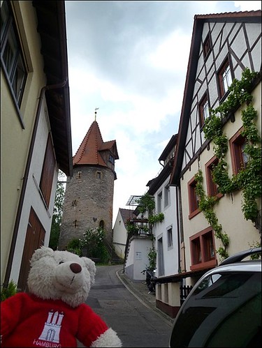
Heidelsheim, Germany - 20th May 2013
By: fam-united
Then we drove to Heidelsheim, which is one of Bruchsal's surburbs. Heidelsheim belongs to Bruchsal since 1974. The river Saalbach also flows through Heidelsheim. The small city was first named in 770 A.D.
|
|
Posted Jun 3, 2013, 4:35 pm
[Quote] [View just this post]
|
|
|
|
|
|
|
Rochester, MN, USA - 13th June 2013
By: sannah
Hi Mom!
Today I arrived at a new destination: I am with sannah in the United States! 
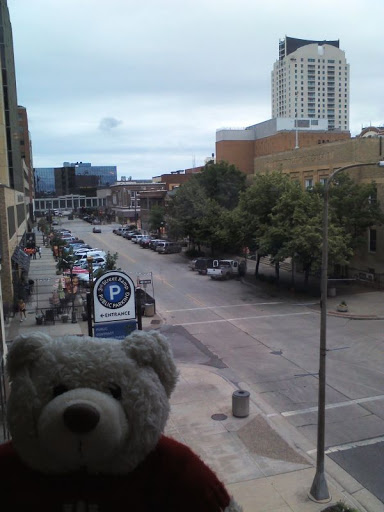
My temporary home now is Rochester, Minnesota. This is one of the most popular buildings downtown, the Plummer Building.

But in the summer, downtown is always crowded on Thursdays because of a market, so sannah did not feel safe taking photos with me downtown, we will come back later.
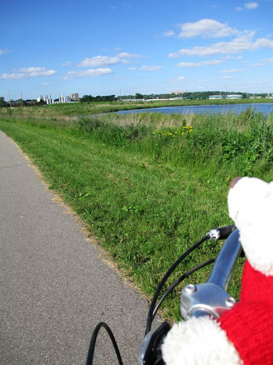
Since the weather today was georgeous (first time with blue sky for weeks! sannah said), we went by bike. There are a lot of bike trails in town allowing us to travel safe without heavy traffic except for serious high speed bikers, people jogging or (the most dangerous kind!) carrying fishermen's gear.
One main bike trail along the Cascade Creek connects sannahs place with downtown.
This is Kutzky Park. The houses on the right are typical for this neighborhood, built around the 1930ers, but still in good shape if they have been taken care of.
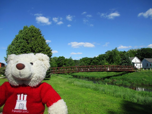
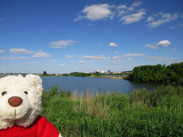
And here we are at Cascade Lake Park. The path is rambling between the creek and (artificial) lakes. In this area has once been an active quarry.
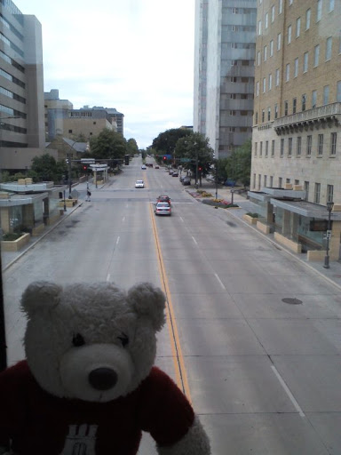
In the distance, you can see the skyscrapers of downtown Rochester:
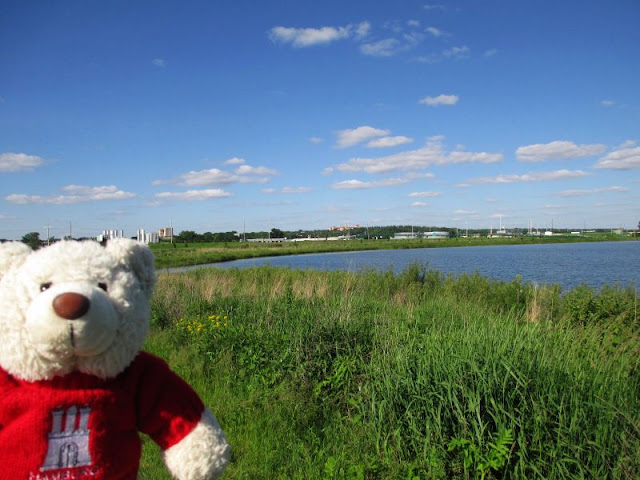
I must admit that it is hard to see, but in the middle of today's last picture, you can see a building complex rising above the horizon: Assisi Heights is a modern monastery.
sannah said that I have just arrived in time for joining her, sannah-man and their other guest Nils on their weekend trip starting tomorrow after lunch!
I am already excited. But I need a little rest first, maybe chatting with Nils - we have met before, do you remember?
All the best,
Michel
|
|
Posted Jun 14, 2013, 12:52 am
[Quote] [View just this post]
|
|
|
|
|
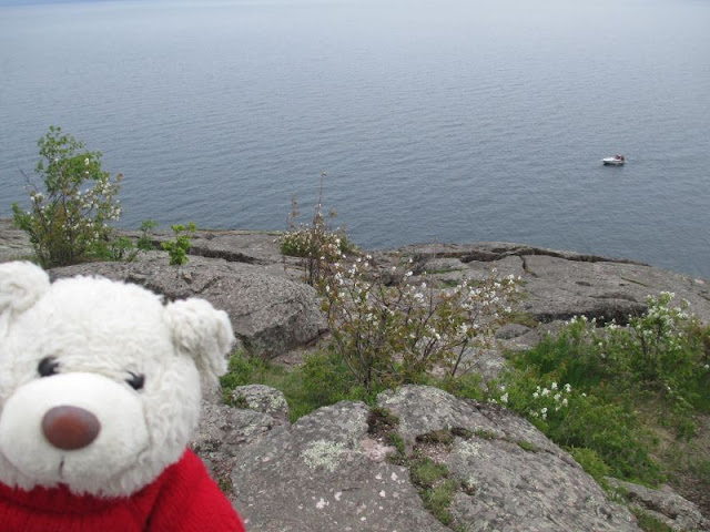
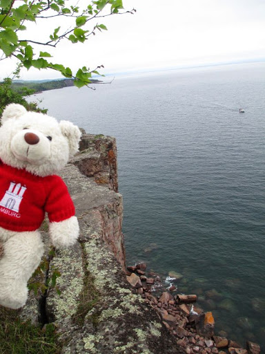
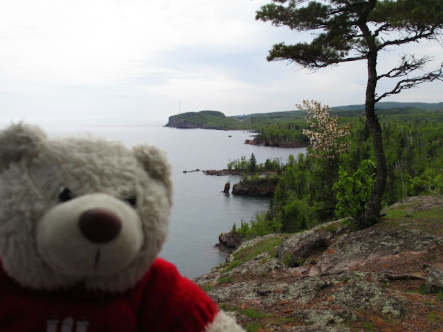
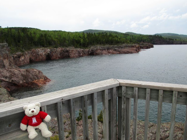
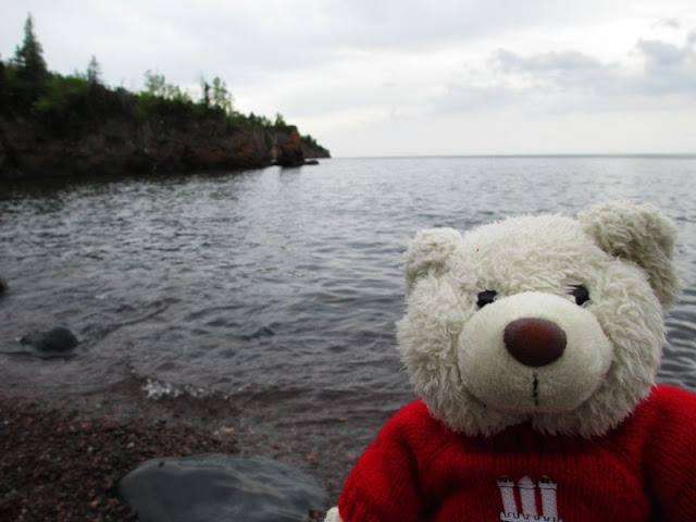
Tettegouche State Park, USA - 15th June 2013
By: sannah
Hi there!
As I promised, our trip has just started in Silver Bay. We later on went to Palisade Head, a large cliff rising about 40-50 meters high above Lake Superior. But luckily, we didnt have to climb there is a single lane road winding to a small parking lot on top of it.
The access is free of charge and the view well, have a look yourself!


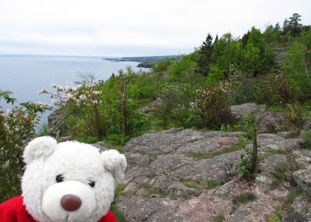
sannah has been told that the hike to the edge of Shovel Point is a nice one. Not too difficult, but not too easy, either! But we had to buy an entrance ticket to the Tettegouche State Park in order to walk there and so we did. And again, the view was awesome, but the weather could have been nicer. A blue sky makes better pictures!


On some photos, you could see Palisade Head in the background - it's the cliff with the antenna.
At the pike of Shovel Point we noticed that there are caves in the cliffs!

A little more from the north shore is about to follow!
All the best,
Michel
|
|
Posted Jun 20, 2013, 2:11 am
[Quote] [View just this post]
|
|
|
|
|
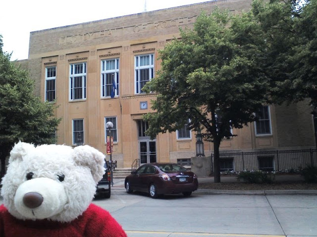
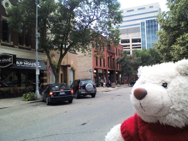
Downtown Rochester, MN, USA - 29th June 2013
By: sannah
Hi there!
Though the weather wasn't really nice today, it was good enough to go out and take some pictures of downtown Rochester!
Rochester is home of the world famous Mayo Clinic. If you are really ill, here someone will take good care of you and try to find a cure. sannah-man works here, too - like about one third(!) of the city's population. While the streets are crowded, especially during lunch hour on workdays, there are less people on the streets on weekends.
sannah took me on a small tour through downtown. We started at the Old City Hall - as far as sannah knows, nowadays there are apartments in that building.
Then we passed the so called Historic Third Street. In those two story buildings there are mostly pubs or restaurants and some antiques shops.
At the Zumbro River, we met the big administration building which does not only contain the modern City Hall of Rochester. It also is the government center for Olmsted County. And sannah is sure that I have seen more than 5 different town halls on my travels - therefore she checked the box: Mission completed!

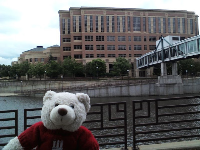
A skywalk connects the government building to the other facilities downtown. Skywalks can be found all over downtown - when it is freezing cold in the winter (and the wind can make that even worse!), no one has to leave the heated buildings to go for lunch or to the parking lot ...
Afterwards, we headed back west to the Peace Plaza - the closest thing Rochester has to a market square!
Nowadays, this is a book store, but once this has been a movie theater!

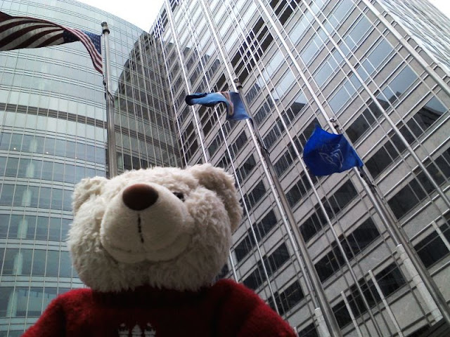
This is the western side of the Peace Plaza - another skywalk and the high building in the back is the Gonda Building - one of the main buildings of the Mayo Clinic and also one of Rochester's highest:

Those three flags show what Rochester is all about. From left to right: United States - Minnesota - Mayo Clinic.
Do you remember this building?
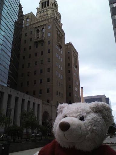
It is the Plummer Building! Dr. Plummer was a physician at Mayo Clinic and planned this building which has been known as "The Clinic Building" until two or three decades ago when Mayo started another expansion ...
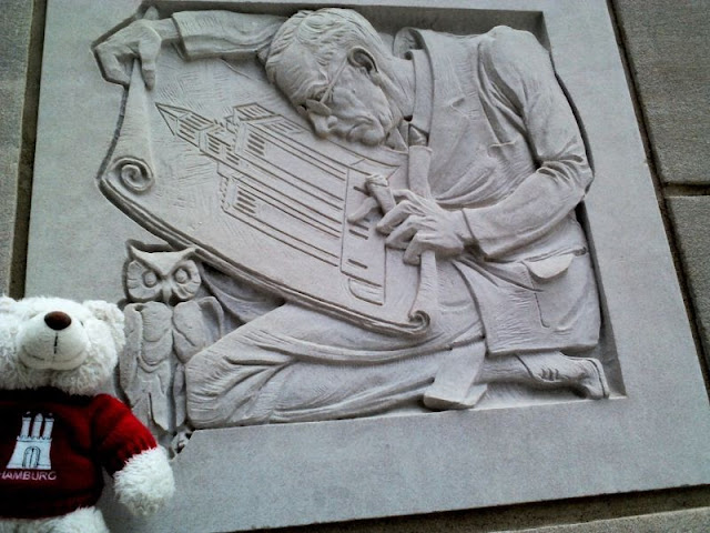
I found some interesting details!
This stone shows Dr. Plummer designing the building ...
... and other stones invited me to play!
This is the main entrance door to the building. Did I say door? I meant portal! I think it is made of bronze, but sannah wasn't sure either.

From a distance, you can see the Plummer Building in total!

At the end of the tour, sannah took me to the skywalk in order to make some photos from a bird's eye view!
This is 1st Ave W ...
... with some old buildings ...

... and 2nd St S.
I think I know the city (sannah calls it "village with big clinic") of Rochester much better now! What about you?
All the best,
Michel
|
|
Posted Jun 29, 2013, 11:35 pm Last edited Jun 29, 2013, 11:37 pm by sannah
[Quote] [View just this post]
|
|
|
Rochester, MN, USA - 13th July 2013
By: sannah
Hi there!
The past days have been weird! sannah and sannah-man pack things into boxes, leave with boxes and come back a little later without them.
sannah told me they are moving house.
She also put Nils and me in a bag in order to keep us safe she said.

I hope this is over soon!
sannah promised me it will and that we are going on another trip afterwards!
Sounds good to me!
All the best,
Michel
|
|
Posted Jul 13, 2013, 5:08 pm
[Quote] [View just this post]
|
|
|
Back Bay, Boston, MA - 20th July 2013
By: sannah
Hi there!
We have just moved in the new apartment and sannah said we are going on a trip as a reward. Yesterday, we went by plane - which was pretty exciting - and landed close to the Atlantic Ocean in Boston, Massachusetts.
Today, we started to explore the city, but it was very hot and humid. So we stayed close to our room in Back Bay, one of Bostons richest districts.
First sannah took us to the MFA, the Museum of Fine Arts. No photos inside, but that is the main entrance.

Then we went back to Copley Place, a famous square surrounded by several historic buildings. Among these are the Boston Public Library,

the Old South Church and the Trinity Church next to the highest building of Boston, the Hancock Tower with 60 floors.
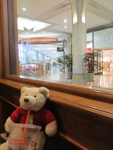
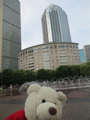
Then we turned southwest back to the center of Back Bay, the Prudential Towers Pru for short. Around office buildings, there is a large shopping mall with several stores. There we had an iced coffee as an refreshment.
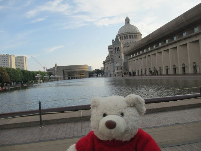
In the evening, the light was very calm, so we took nice pictures at the Plaza between Pru and First Church of Christ, Scientist.
Tower 3 in the background. A lot of youngsters enjoyed running and playing in that fountain!
The dome belongs to the First Church of Christ, Scientist.
Looking back to Pru.

Temperatures are supposed to cool down overnight I hope that will happen. sannah is going to explore more of the city with us in the following days.
All the best,
Michel
|
|
Posted Jul 21, 2013, 5:01 am
[Quote] [View just this post]
|
|
|
Freedom Trail, Boston, USA - 21st July 2013
By: sannah
Hi there!
Boston is a very historic city! You might have heard of the Boston Tea Party which was leading to the independence of the former colonies from the British Empire. Well, there was a lot more than just this tea party going on in the 1770s. The Freedom Trail is a walk along all the historic places that have something to do with the way to freedom. It is marked by red bricks and lots of other tourists followed it yesterday.

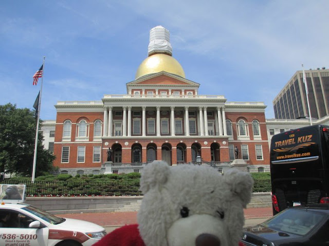
The Freedom Trail starts at Boston Common, which is to Boston what the Central Park is to New York. The first impressive building we saw was the State Capitol of Massachusetts. There is a little tower on top of the golden dome, but it obviously needed repairs.
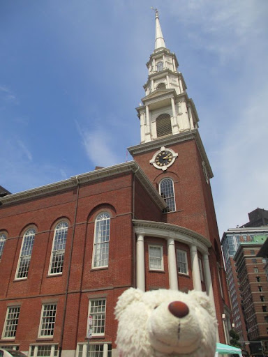
The nice Park Street Church was built shortly afterwards. Here William Lloyd Garrison gave his first public speech against slavery.
The Granary Burying Ground is the third oldest burying ground in Boston. The five victims of the Boston Massacre are buried here, as well as Samuel Adams who signed the Declaration of Independence.

Kings Chapel does not really look like a church, what do you think? What caught my eye was that people would not sit in lines of benches, but in little red plush booths. I have not seen anything like that before looks more like an opera to me!

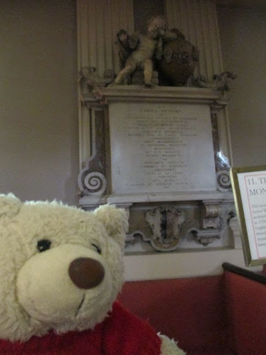
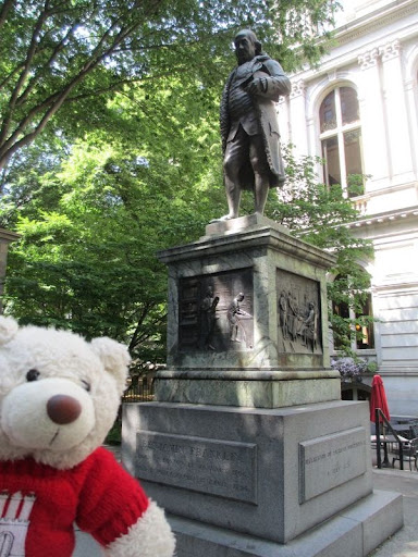
Next to the Old City Hall is the site of the First Public School in the U.S. (founded in 1635).

Benjamin Franklin is an alumni of this Boston Latin School, his monument now marks where the school once has been.
The Old South Meeting House is the second oldest church in Boston. It was used for public meetings the biggest one was in 1773 when more than 5000 people protested against the tax on tea.

The Old State House Museum is both the site of the Boston Massacre in 1770 and six years later, the Declaration of Independence was read from this east balcony.


Faneuil Hall still is the market place and public gathering space it has always been. There are lots of pubs and restaurants around that area in downtown Boston.

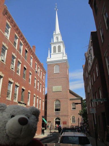
Those sites have all been very close. The trail now continued facing north to the North End which now is the Italian quarter of Boston with lots of Italian restaurants. It also is home of Paul Revere who was a silversmith and is most famous for his midnight ride when he announced British troops were coming to fight.
From the Old North Church with its widely visible tower, two lanterns were hung that started Reveres ride. This action is often regarded as the spark that ignited the American Revolution.
From the North End we crossed the St. Charles River and entered the quarter called Charlestown. In the Navy yard, the USS Constitution is anchored, the oldest commissioned warship afloat in the world! You also have a great view of Bostons skyline from here.

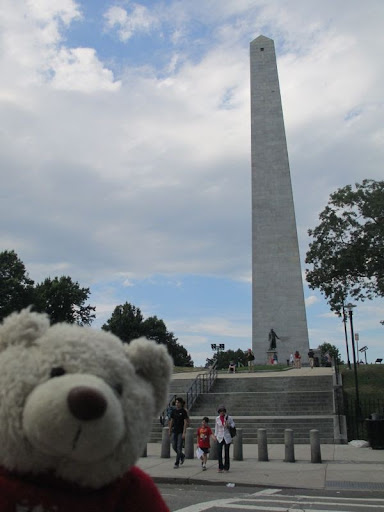
The last site is the Bunker Hill Monument. The Battle of Bunker Hill was one of the bloodiest battles of the American Revolution on June 17, 1775: ill-equipped, but determined Colonists where fighting the powerful British Army. 1400 dies where nowadays the 67m obelisk commemorates this first major battle.

Now we reached the end of the more than 4km long Freedom Trail. Luckily, sannah carried us around our feet and little legs would have hurt a lot! See, the red line shows the long way we went.

It was a nice day and we learned a lot!
All the best,
Michel
|
|
Posted Jul 22, 2013, 3:26 pm
[Quote] [View just this post]
|
|
|
Prudential Tower Skywalk, Boston, USA - 22nd July 2013
By: sannah
Hi there!
We continued exploring the city. In order to get an overview, we took the elevator up to the 50th floor of the Prudential Tower. The elevator went so fast that that our little ears started to hurt a bit. But WOW what a view!
We started facing east: The tall building is the Hancock Tower at Copley Square, the highest building of Boston.

The Charles River north of the Prudential Tower is leading to the Massachusetts Bay (and therefore into the Atlantic).

On the other side of the Charles River, Cambridge is located with one of the most famous universities of the world: Harvard. And even closer to the river is another well known institution: the MIT the dome right of the bridge.

This is Fenley Park, the baseball stadium of the Red Sox. Baseball is quite important in Boston since its the season. In a few weeks, American football with the NE Patriots will start again.
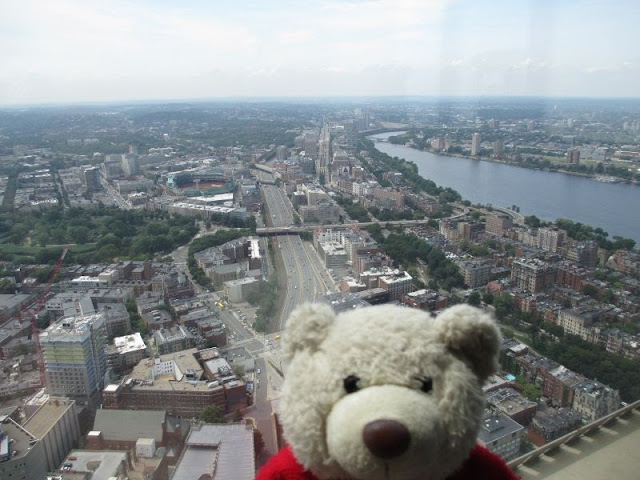
To the southeast, Boston is secured of the power of the Atlantic Ocean by several small islands.

On the inner wall of the building, a permanent exhibit provided information about Bostons history, celebrities, sports teams, immigration or trivia.

Between feet and miles, a smoot is a local unit of length. Its just a matter of definition!

With all the red brick buildings, Boston reminds me a little of Hamburg. Would you agree, Mom?
All the best,
Michel
|
|
Posted Jul 25, 2013, 4:01 pm Last edited Jul 25, 2013, 4:01 pm by sannah
[Quote] [View just this post]
|
|
|
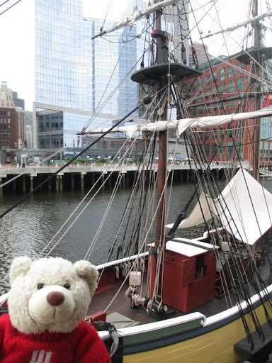
Tea Party Site, Boston, USA - 22nd July 2013
By: sannah
Hi there!
When I reported on the Freedom Trail, I mentioned the Boston Tea Party the well know incident in 1773 when Colonists, supposedly dressed as Native Americans, dropped English Tea overboard in order to show what they thought about taxation. Read more here!
However, the actual site of the Tea Party is not part of the Freedom Trail for whatever reason.
So sannah took Nils and me there later. The museum is supposed to be very nice and offers some historical reenactment, but we arrived late that day and the last show was already running.
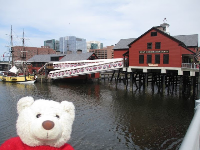
This is one of the vessels used for bringing goods into the inner harbor. The tea was dropped into the harbor here and it was reported that the water was tinted for days because of the amount of tea.
Are you ready to have a tea party now?
On our way back downtown, we passed the Government Center. Comparing the Old City Hall on the Freedom Trail and this new City Hall of Boston, I like the old one a lot better!
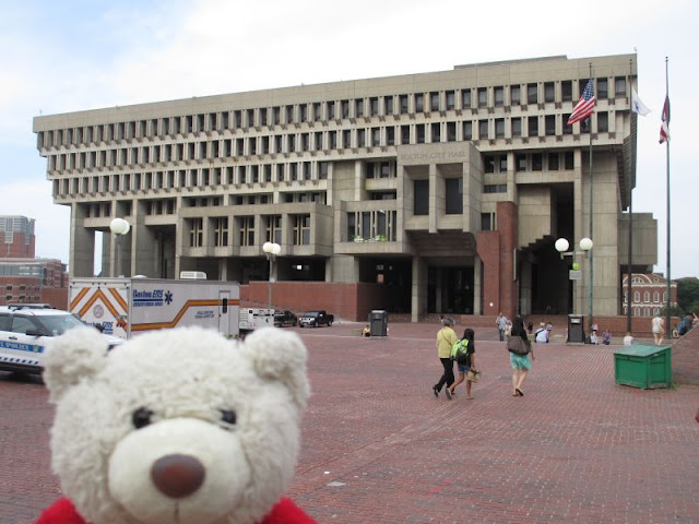
But in general, Boston has priven to cherish its historic heritage, it is a good mixture of old and new! I like this city.
All the best,
Michel
|
|
Posted Jul 25, 2013, 5:14 pm
[Quote] [View just this post]
|
|
|
